Wednesday, August 22, 2012
The Pacific at last - 21 August 2012
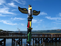
Today we finally had our first glimpse of the Pacific, even though we have been on the coast for a few days, we have been in inlets such as Puget Sound and Willapa Bay. Today there was nothing to the west of us until Japan.
Not far from our overnight stop was Long Beach (WA, not CA) where each August they hold the Washington Kite Festival so we detoured to have a look. Not being the weekend it was a little quieter than it might have been but nevertheless there was still sufficient colour in the sky to make quite a spectacle.
We were able to watch Ray Bethell, holder of 11 multiple world records, flying three stunt kites simultaneously; one in each hand and one controlled by strings attached to his belt: most impressive. His record is 39 kites simultaneously - not sure how he manages that!
There was a team of six guys flying stunt kites in formation as well as all manner of tube, box, delta, wing, and fantasy kites colouring the sky.
But we could not stay all day, we had to move along and we continued south to Astoria. Named after, but never visited by the first multi-millionaire Astor, it is has a historic Finnish section and many Victorian era buildings and a fantastic viewpoint up on the hill overlooking the Columbia and Young Rivers which meet here. Lewis and Clark finally reached the Pacific Coast on the north bank of the Columbia before they turned back to report their findings to President Jefferson.
But, to reach Astoria, we had to cross the longest trestle bridge in the world, 4.1 miles across the Columbia River with an absolutely enormous ship passing under us as we crossed, giving a sense of scale to the bridge.
Our next stop of note was the neat little seaside town of Cannon Beach where the attraction is a fabulous golden sand beach and a string of sea stacks, huge rock outcrops left behind as the sea has eroded the land. The largest, Haystack, is off the beach at Cannon Beach but others can be seen dotted up and down the coast.
Having had a thoroughly enjoyable relaxing day we needed to cover some miles to our destination at Lincoln City so there was only time for occasional photo stops as we motored south.
173 miles today, total trip 6145. States: Washington, Oregon.
Tuesday, August 21, 2012
On the road again - 20 August 2012
One of the reasons for a road trip across America was to catch up with family in the Pacific Northwest. So we took a few days out to spend time with Bradley, Susan and Linnea as well as a side trip over the border to see our good friends David & Rachel.
Bradley had arranged a whale watching boat trip from Anacortes which we enjoyed on Saturday but the rest of the time was simply spent relaxing.
This morning saw the start of the second leg of the trip as we changed from a westerly heading to a southerly heading down the Pacific Coast bound for Los Angeles. Bradley suggested that we should leave the I-5 at Hwy 20 and take the Deception Pass bridge to Whidbey Island then the Coupeville to Port Townsend ferry back to the Olympic Peninsula, thus completely avoiding all the traffic snarl around Seattle. It also meant that most of the trip was along various coasts, bays or inlets and thus much more scenic than a motorway.
Curiously, the ferry captain announced that they had to perform a Coast Guard mandated safety drill and, so mid-channel, the ferry came to a dead stop, they lowered a rigid inflatable lifeboat, put two crew aboard and they set off for shore while we got under way again. Apart from proving that they could deploy this boat and that it was operational in the water, I have no idea what the exercise actually proved. Nevertheless it was an interesting diversion.
We spent a little while browsing the shops in the historic part of Port Townsend, all of which were full of wares designed to part tourists from their dollars; we resisted. After that there was a long run alongside the Hood Canal which does not actually seem to be a canal, more a sizable inlet; and then over to the Pacific Coast and our stop for the night at Willapa Bay
231 miles today, total trip 5972. States: Washington (and British Columbia, briefly)
Friday, August 17, 2012
Cascading into Washington - 15 August 2012
An interesting morning was spent exploring the Winthrop enviorons. Firstly the town itself has re-invented itself as an early 1900s Western town with wooden sidewalks, hitching posts, old fashioned signwrighting as mandatory, wooden sidings, corrugated iron roofs and so forth. It looks kust like the set from a Wild-West movie apart from the absence of horses and stetson (being worn, plenty to purchase) and presence of modern transportation..
Above the town is the Schafer Museum which was quite an amazing and interesting collection of historical buildings and memorabilia from the area's history, from the gold-mining and apple growing past.
A few miles from Winthrop is the original Smokejumper base and we were privildeged to have a personal tour and explanation of this fascinating facility. The base is very self sufficient, as they make, on-site, all the specialized equipment, jumps suits, packs, etc and repair (but not make) all the parachutes.
Then it was time to get back on Hwy 20 for the scenic route across the North Cascades, stopping at the all the available viewpoints before we turned off and headed north to Bellingham, to be with family for the next few days.
177 miles today, total trip 5654. States: Washington.
Wednesday, August 15, 2012
Central Washington - 14 Auguat 2012
Spokane was just down the road so we stopped there for breakfast in the Riverside Park along with the homeless still asleep on the park benches. After a quick look at the Spokane Falls we swapped the mountains and conifers for rolling hills with grain in the middle of the harvest season. Some fields cut, others being harvested and some very ready for the combine to visit.
There was an abrupt change in the topography as the grain fields ceased and were replaced with rocky lands covered in sage brush and then suddenly it was back to fertile wheat fields as far as the eye could see.
The roads were die straight for miles the only variation being altitude as we rolled across central Washington then descended to the Columbia River and the Grand Coulee Dam.
Built as part of the New Deal to create employment after the Great Depression, the Grand Coulee Dam was, until 4 years ago, the largest dam in the world, nearly a mile across, and until three weeks ago, the generators in the most recent power plant were the largest in the world. The Chinese have just commissioned generators with a whisker more capacity than the units at Grand Coulee.
We took the dam tour which after the requisite post-911 screening and accompanied by a federal guard, took us to the pump house where they pump 3% of the river water 85m up to Banks Lake from where it irrigates many thousands of acres of otherwise arid land and grows most of the mint and lots of potatoes for the USA.
Although the biggest hydro producer in the USA and one of the biggest in the world, irrigation, not electricity, was the prime reason the dam was built, electricity is just a very useful by-product.
Instead of taking the direct route from Grand Coulee we ventured north to pick up the scenic route along Hwy 20 into Winthrop passing through orchard territory along the rivers. Anywhere within pumping distance of the rivers is verdant green, beyond that boundary is burnt dry dusty brown at this time of the year.
231 miles today, total trip 5475, States: Washington
Ribbon of blue - 13 August 2012
Although there were no "must see" sights on the itinerary for today, it was nevertheless quite a scenic trip. As we are in the mountains rather than the plains there are no direct roads west from Whitefish, MT to our next stop in Newport, WA so the day was spent zig-zagging up towards and away from the Canadian border following a ribbon of blue rivers and hydro lakes through forests of firs, pines and spruce.
The first hydro lake was on the Kootenai River creating Koocanusa Lake which went for miles and miles. We only followed a portion of the USA part as the lake reaches way back into Canada, hence the name - no doubt. Not far downstream from the dam was an unexpected highlight, the Kootenai Falls, which though neither especially high or wide are quite spectacular with the various rock ledges that the water cascades over and around.
Just after crossing into Idaho, we left the Kootenai River and dropped south through the forest (without any water) to pick up the Pend Orielle River which we followed until it became Lake Pend Orielle, another hydro lake.
We followed the shoreline up and over the top, crossing Pack River and Priest River to the delightful town of Sandpoint where they claim to have the world's longest retail bridge. It is constructed out of huge tree trunks and is quite a delightful space.
The difference between this and the "real" retail bridges such as Rialto and Ponte Vecchio is that the street has entirely disappeared and it was originally built as an ordinary bridge and the shops were an entrepreneurial experiment when the bridge fell into disuse.
All too soon, but only after the best value ice-cream in the USA at Clark Fork, Idaho had been and gone and we were in Washington State and the Pacific Northwest.
308 miles today, total trip 5238. States: Montana, Idaho, Washington.
Monday, August 13, 2012
Coming back from the sun road - 12 August 2012
The day had a very early false start when the alarm sounded at 0200. A meteorite shower was occurring and the sky was partly cloudy when we turned in. We were told 0200 would be the best time and since there is almost zero light pollution in this part of Montana we decided it was worth a wake-up call. We saw total overcast and went back to bed, to wake to a cloudless sky in the morning. Nature can be cruel sometimes!
In the trip planing we had decided to follow the Wise Men's example and return by a different route and I was sure that I had read the West to East was the best way to make the trip over Going-to-the-Sun Road. In endeavouring to confirm that detail I found so many comments that suggested both ways were good and since the day dawned cloudless we decided to enjoy the views along Going-to-the-Sun Road in the opposite direction.
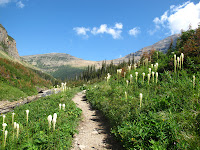
As before there were plenty of stops for photos and a walk to Sun Point and the Barring Falls. All in all a slow, relaxing and fantastically scenic day.
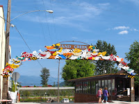
After checking in at Whitefish we set off to see the town which has had the main shopping street remodelled, reasonably recently by the look of it. It is really very quaint and well done making it a most appealing looking town.
After attempting to access the lake and finding our way blocked by a fee required State Park, we stumbled upon the town beach which was free and enjoyed a refreshing dip in this surprisingly warm glacial lake followed by picnic dinner in a gazebo overlooking the lake.
97 Miles today, total trip 4930. States: Montana.
In the trip planing we had decided to follow the Wise Men's example and return by a different route and I was sure that I had read the West to East was the best way to make the trip over Going-to-the-Sun Road. In endeavouring to confirm that detail I found so many comments that suggested both ways were good and since the day dawned cloudless we decided to enjoy the views along Going-to-the-Sun Road in the opposite direction.
As before there were plenty of stops for photos and a walk to Sun Point and the Barring Falls. All in all a slow, relaxing and fantastically scenic day.
After checking in at Whitefish we set off to see the town which has had the main shopping street remodelled, reasonably recently by the look of it. It is really very quaint and well done making it a most appealing looking town.
97 Miles today, total trip 4930. States: Montana.
Subscribe to:
Comments (Atom)


