Friday, August 17, 2012

Cascading into Washington - 15 August 2012

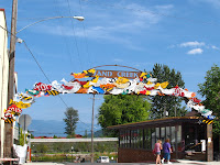
An interesting morning was spent exploring the Winthrop enviorons.  Firstly the town itself has re-invented itself as an early 1900s Western town  with wooden sidewalks, hitching posts, old fashioned signwrighting as mandatory, wooden sidings, corrugated iron roofs and so forth.  It looks kust like the set from a Wild-West movie apart from the absence of horses and stetson (being worn, plenty to purchase) and presence of modern transportation..

Above the town is the Schafer Museum which was quite an amazing and interesting collection of historical buildings and memorabilia from the area's history, from the gold-mining and apple growing past.

A few miles from Winthrop is the original Smokejumper base and we were privildeged to have a personal tour and explanation of this fascinating facility.  The base is very self sufficient, as they make, on-site, all the specialized equipment, jumps suits, packs, etc and repair (but not make) all the parachutes.

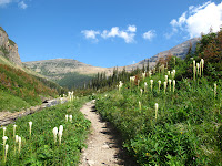
Then it was time to get back on Hwy 20 for the scenic route across the North Cascades, stopping at the all the available viewpoints before we turned off and headed north to Bellingham, to be with family for the next few days.

177 miles today, total trip 5654. States: Washington.

Wednesday, August 15, 2012

Central Washington - 14 Auguat 2012

Spokane was just down the road so we stopped there for breakfast in the Riverside Park along with the homeless still asleep on the park benches.  After a quick look at the Spokane Falls we swapped the mountains and conifers for rolling hills with grain in the middle of the harvest season. Some fields cut, others being harvested and some very ready for the combine to visit.

There was an abrupt change in the topography as the grain fields ceased and were replaced with rocky lands covered in sage brush and then suddenly it was back to fertile wheat fields as far as the eye could see.

The roads were die straight for miles the only variation being altitude as we rolled across central Washington then descended to the Columbia River and the Grand Coulee Dam.

Built as part of the New Deal to create employment after the Great Depression, the Grand Coulee Dam was, until 4 years ago, the largest dam in the world, nearly a mile across, and until three weeks ago, the generators in the most recent power plant were the largest in the world.  The Chinese have just commissioned generators with a whisker more capacity than the units at Grand Coulee.

We took the dam tour which after the requisite post-911 screening and accompanied by a federal guard, took us to the pump house where they pump 3% of the river water 85m up to  Banks Lake from where it irrigates many thousands of acres of otherwise arid land and grows most of the mint  and lots of potatoes for the USA.

Although the biggest hydro producer in the USA and one of the biggest in the world, irrigation, not electricity, was the prime reason the dam was built, electricity is just a very useful by-product.

Instead of taking the direct route from Grand Coulee we ventured north to pick up the scenic route along Hwy 20 into Winthrop passing through orchard territory along the rivers.  Anywhere within pumping distance of the rivers is verdant green, beyond that boundary is burnt dry dusty brown at this time of the year.

231 miles today, total trip 5475, States: Washington

Ribbon of blue - 13 August 2012

Although there were no "must see" sights on the itinerary for today, it was nevertheless quite a scenic trip.  As we are in the mountains rather than the plains there are no direct roads west from Whitefish, MT to our next stop in Newport, WA so the day was spent zig-zagging up towards and away from the Canadian border following a ribbon of blue rivers and hydro lakes through forests of firs, pines and spruce.
The first hydro lake was on the Kootenai River creating Koocanusa Lake which went for miles and miles. We only followed a portion of the USA part as the lake reaches way back into Canada, hence the name - no doubt.  Not far downstream from the dam was an unexpected highlight, the Kootenai Falls, which though neither especially high or wide are quite spectacular with the various rock ledges that the water cascades over and around.

Just after crossing into Idaho, we left the Kootenai River and dropped south through the forest (without any water) to pick up the Pend Orielle River which we followed until it became Lake Pend Orielle, another hydro lake.

We followed the shoreline up and over the top, crossing Pack River and Priest River to the delightful town of Sandpoint where they claim to have the world's longest retail bridge.  It is constructed out of huge tree trunks and is quite a delightful space.
The difference between this and the "real" retail bridges such as Rialto and Ponte Vecchio is that the street has entirely disappeared and it was originally built as an ordinary bridge and the shops were an entrepreneurial experiment when the bridge fell into disuse.

All too soon, but only after the best value ice-cream in the USA at Clark Fork, Idaho had been and gone and we were in Washington State and the Pacific Northwest.

308 miles today, total trip 5238. States: Montana, Idaho, Washington.

Monday, August 13, 2012

Coming back from the sun road - 12 August 2012

The day had a very early false start when the alarm sounded at 0200. A meteorite shower was occurring and the sky was partly cloudy when we turned in. We were told 0200 would be the best time and since there is almost zero light pollution in this part of Montana we decided it was worth a wake-up call.  We saw total overcast and went back to bed, to wake to a cloudless sky in the morning. Nature can be cruel sometimes!

In the trip planing we had decided to follow the Wise Men's example and return by a different route and I was sure that I had read the West to East was the best way to make the trip over Going-to-the-Sun Road.  In endeavouring to confirm that detail I found so many comments that suggested both ways were good and since the day dawned cloudless we decided to enjoy the views along Going-to-the-Sun Road in the opposite direction.

As before there were plenty of stops for photos and a walk to Sun Point and the Barring Falls.  All in all a slow, relaxing and fantastically scenic day.

After checking in at Whitefish we set off to see the town which has had the main shopping street remodelled, reasonably recently by the look of it. It is really very quaint and well done making it a most appealing looking town.
After attempting to access the lake and finding our way blocked by a fee required State Park, we stumbled upon the town beach which was free and enjoyed a refreshing dip in this surprisingly warm glacial lake followed by picnic dinner in a gazebo overlooking the lake.

97 Miles today, total trip 4930. States: Montana.


Sunday, August 12, 2012

Going-to-the-Sun-Road - 11 August 2012


This romantically named road was carved out of the mountainsides in the 1930s and is now a National Civil Engineering Landmark, a National Historic Landmark and is on the Register of Historic Places, the only road in the US with all three designations.

The name comes from 2939m high Going-to-the-Sun Mountain which dominates the central part of the drive.

Apparently referred to as the Mt Everest of routes for motorcyclists, it is not really a patch on the alpine passes of Europe for driving fun, but a great drive, nevertheless.

There are ample pull-off places for photography stops but only one major carpark at Logan Pass.  The info says that the carpark is full by 10:30 and that was certainly our experience. Within 15 minutes of our arrival, there was not a park to be had and 2 hours later when we were about to leave the
"vultures" were circling ready to pounce on anyone looking like they were heading for a vehicle.  I considered offering our park on eBay but there was no 3G signal, scuppering a fantastic money-making proposition.


It is only 50 miles from end to end but photo stops and walks extend the trip to fill the bulk of the day quite easily.  To round off the day we drove north from St Mary to the booming metropolis of Babb (Pop. 1 horse) and then up to Many Glacier where we went bear hunting and if we had been lucky enough to capture a shot of
Goldilocks we could have completed the set as we were privileged enough to see a big old daddy grizzly and a mother black bear with a cub. Because we spent too long snapping the grizzly we missed the spectacle of a moose ambling over the road and swimming across the lake to the other side.  When we arrived the moose was still distinguishable on the far shore, about a kilometre away..
The bears were totally oblivious to their furiously snapping adoring public as they occupied themselves working their way through their quota of 100,000 huckleberries per day that they eat during the summer to prepare for the winter hibernation.

107 miles today, total trip 4833  States: Montana

Glacier National Park - 10 August 2012

Almost due north of Missoula is Glacier (or Glayshah, as the locals call it) National Park and the skies got bluer and the hills got clearer as we got nearer. Leaving Missoula there was a distinct change in the scenery almost immediately as the foothills had a slight tinge of green about them rather than the very dry brown of yesterday.

The first feature of note was Flathead Lake, the shores of which are the source of Flathead cherries, and which is the biggest natural freshwater lake west of the Mississippi.  That is quite surprising as it is not really that large.

Following advice from the park Visitor Centre we took the free 12-seater shuttle bus up to the Avalanche Lake stop arriving about 1600 and set off on the 2.5m walk to Avalanche Lake.
Mindful of the time that the last shuttle left (1800) we romped past all the other walkers on the track - and there were plenty, stopped briefly to photograph and Elk (?) and got to the lake in time for a short rest and a few photos before making the downhill return trip.

Back at the shuttle bus stop at 1745 we were a little dismayed to see a queue of 24 people ahead of us.  Three shuttle buses arrived, already full and one actually added people to the queue.  It looked as though a situation was developing.  However, the bus organisers are obviously used to this problem and a 40-seater bus turned up to take us all back to base.
166 miles today, total trip 4726. States: Montana

Friday, August 10, 2012

Between fire and ice - 9 August 2012

"In a gorgeous locale surrounded by rolling green hills and pine forests and framed by snowcapped peaks, Bozeman is the coolest town in Montana"  Lonely Planet, USA

With a write-up like that why would you not detour to visit?   Reality was: In a fugg filled valley surrounded by mirky skies that completely obliterated any hills or forests that might exist, Bozeman was the most disappointing sight in Montana.

In fact, Montana all told has been disappointing.  We were promised exciting vistas and big skies but when the sky is full of smoke from local forest fires and the hills are burnt brown from the summer sun, the pallette is distictly uniformly boring drab.

However, before we got to Bozeman we had a delightful run up the Gallatin River valley where the hills were pine-clad and the river was crystal clear and the road was not too busy.  Although we started and ended in Montana, we briefly dipped back into Wyoming and back into Yellowstone National Park as we motored north.

Yesterday we crossed and re-crossed the Continental Divide as we motored the Grand Loop Road, but today we crossed it permanently and are now officially on the western, Pacific, side, just that little bit closer to home.

From Bozeman it was drab brown all the way to Missoula our stop between the fire of Yellowstone National Park and the ice of Glacier National Park and where we were introduced to Huckleberries in the form of Huckleberrry ice-cream.

310 miles today, total trip 4560. States Montana, Wyoming.