Sunday, March 05, 2006

Roydon - 5 March 2006

Proud pikerSunday was another fabulous day so we thought we would return to the Lee River area that we enjoyed last weekend.

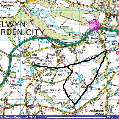
We could not find a suitable circular walk so created our own courtesy of the Ordnance Survey website maps. It turned out to be just over 10 miles.
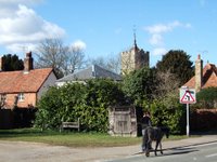
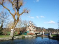
Roydon lock-ups and stocksLeaving Stanstead Abbotts we walked along the Lee Navigation to the point where it joins the Stort Navigation which we followed as far as Roydon.

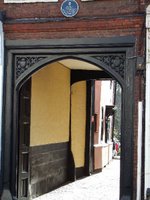
Leaving the route briefly we detoured to a pub for lunch and to look at the original lock-up and stocks opposite the village green which, until 1840, every parish had to provide to accommodate criminals before they went to court.
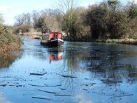
Icebreaking narrow-boatThere were three ‘firsts’ on this walk. The first Pike we had seen caught, the first time we had seen a narrow-boat in the role of an icebreaker and the first deer that stood still long enough to be photographed. Wild deer
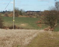


Image produced from the Ordnance Survey Get-a-map service. Image reproduced with kind permission of Ordnance Survey and Ordnance Survey of Northern Ireland.
Quainton - 4 March 2006

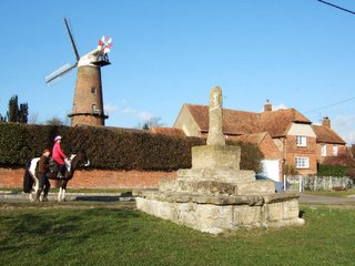
Quainton windmill and preaching crossOur Saturday walk was a little over 10 miles and took in 4 villages in the Vale of Aylesbury starting from Quainton. While Quainton is a quaint to’n that is not the reason for the name: it is, instead, a corruption of old English Cwene-tun or Queen’s Manor. Quainton’s claim to fame is the tallest windmill in the county and the remains of a C15th preaching cross.

Cobweb Cottage complete with spiderThe walk description said “indistinct field paths” and they certainly were. Most paths here, if not very well defined, are at least discernable; but for most of this walk we had no indication that anyone had ever passed that way before.

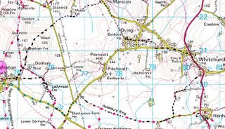
After a midday snack in a pub in the pretty village of Whitchurch we made our way back to Quainton.

Image produced from the Ordnance Survey Get-a-map service. Image reproduced with kind permission of Ordnance Survey and Ordnance Survey of Northern Ireland.
Sunday, February 26, 2006

USA Today - 26 February 2006

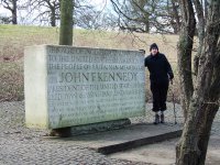
John F Kennedy MemorialWe managed to visit a part of the US today without having our fingerprints or iris scans recorded.

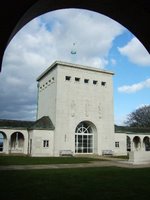
Air Force MemorialNear the spot where King John signed the Magna Carta in 1215 is a memorial to another leader, also John, who in his inaugural address pledged to defend liberty, a concept originally spelt out in the Magna Carta. To remember Kennedy’s death in 1963, the people of Britain transferred and vested an acre of land in the USA making it possible to step on to American soil a mere 30 minutes drive from the centre of London.

ABA Magna Carta MemorialNot far away is the Magna Carta memorial, erected by the American Bar Association and the whole area is overlooked by the Air Force Memorial to the airmen and women of Britain, Canada, Australia, New Zealand, South Africa and India who died in the Second World War.

All in all it was a memorial day reflecting the defence of liberty and democracy that we take so much for granted.

Saturday, February 25, 2006

Hertford - 25 February 2006

Hertford Lock Saturday was a brilliant clear day so ignoring the rather cool breeze we set off for Hertford. From there we walked to Ware and back. Across the Mead towards WareWare is a very old settlement going back way before Roman times. It was on one of the main Roman roads (Ermine Street) and was a major coaching stop in later years. Now the A10 viaduct races across the Mead bypassing Ware and leaving it a peaceful place. One claim to fame is that it was the original home of the Great Bed of Ware.

Coaching InnThe Great Bed of Ware is 10ft 9inches by 10ft 9inches, big enough for 12 people, and was purchased as a promotional gimmick for an inn in Ware during the 1570s. It is now on display at the Victoria and Albert Museum in London. The bed cover was hand-made to fit the giant bed and would have cost more to produce than the great bed itself due to the cost of the fabric, cottons and the time it would have taken to stitch it.” Gazebos on the river
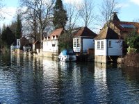
Another interesting feature is the Gazebos along the riverbank. Dating from the C18th they are still an attractive feature to have a the bottom of one’s garden.

Sunday, February 19, 2006

Spring is in the air - 18 February 2006

Easton Lodge lake
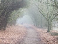
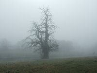
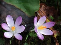
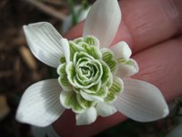
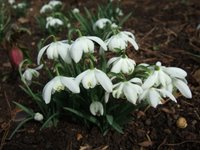
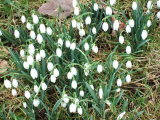
Spring is in the air, foggy walks notwithstanding. After a walk in the area of Hertingfordbury we went on to look at the snowdrops at Benington Lordship. Snowdrops are quite amazing in that much of their beauty is concealed from the casual viewer. CrocusesTake the double snowdrop for instance; unless you get down and turn the flower upside down you have no idea of the beauty within.

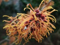
Inside the snowdropThen it was on to the Gardens of Easton Lodge for more snowdrops, but they were not that fantastic. We did find another flower having a ‘bad hair day’ which was quite attractive. All the casual observer sees

There is no grand house at Easton, the last Lodge having burned down in the winter of 1918 in unusual circumstances that could only happen in the UK. Witch Hazel“A sick monkey was hospitalised in the night nursery. It was given a coal fire and a blanket to keep warm. It put the blanket on the fire and ran around the house with this blazing torch.” The house was razed; the fate of the monkey is unknown. Image produced from the Ordnance Survey Get-a-map service. Image reproduced with kind permission of Ordnance Survey and Ordnance Survey of Northern Ireland.
Sunday, February 12, 2006

Snowdrops - 11 February 2006

Snowdrops
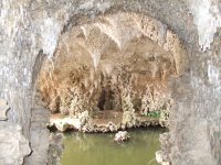
Painshill Park grotto looking out to lakeSnowdrop time has rolled around once again so it was time to hit the road and go snowdrop hunting. Since there was a small task requiring attention in Reigate we headed to the south of London once again.

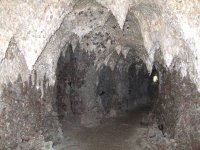
Painshill Park grottoPainshill Park (visited in December) advertised Snowdrop Sunday for 12 February so it was a fairly safe bet that the snowdrops would also be there on Saturday 11th. Added to that was the fact that we could not see the Grotto last time as Santa was in residence. The grotto at Painshill Park turned out to be the best we have seen so far, The whole Painshill project bankrupted the chap who built it and when you see the effort that went into the grotto it is not hard to see why. (Note the small daylight opening in the photo: when viewed from a grille by the entrance it provides a marvellous optical illusion that the grotto is much longer than it actually is.)

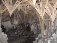
Painshill Park grotto showing timber frameworkHe attempted to recreate nature as in the caves he had seen on his Grand Tour of Europe: volcanic caves lined with stalactites. The “volcanic” rocks are hot-house cinders and the stalactites are crystals of gypsum, calcite, quartz and fluorite held in place by plaster on wooden formers.

After inspecting the grotto and the fake underground waterfalls and streams we wandered over to the snowdrops and then drove to Leigh (pronounced lie) to start a walk to Betchworth and back.

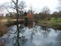
River Mole

There was no particular attraction that drew us to Betchworth: that was just where the walk went. However, the Betchworth church was the scene of the first wedding in Four Weddings and a Funeral, and the Dolphin Pub offered delicious Broccoli & Stilton soup for a winter lunch. We came across snowdrops in the wild along a stream bank on the return journey.
Map courtesy of Ordinance Survey website

Image produced from the Ordnance Survey Get-a-map service. Image reproduced with kind permission of Ordnance Survey and Ordnance Survey of Northern Ireland.
Sunday, February 05, 2006

Polesden Lacy - 5 February 2006

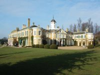
Polesden LacyIt was to the south of London that we journeyed for our Sunday afternoon walk: focused around the National Trust property of Polesden Lacy. Polesden valley

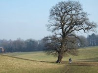
We parked at the nearby town of Westhumble and enjoyed typical English winter countryside vistas as we made our way up the Polesden valley.

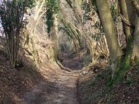
We ignored the printed directions and went through the Polesden Lacy grounds, the house being shut for the winter. Exiting the opposite side we rejoined the route for a mile or two along a typical English “hollow”, Hogden Lane. An English Hollow

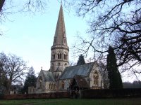
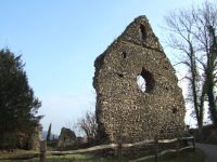
From there we joined the North Downs Way with expansive, if somewhat hazy, views to the south, on past St Barnabas Church St Barnabas Churchand back to Westhumble past the Chapel ruins that are, judging by the sign, the town motif.
Westhumble chapel ruins
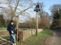
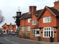
As we were not far from the Arbinger villages we went to see the ‘Jack the Westhumble town signHammer’ a mechanised blacksmith that strikes a bell to sound the hours in the village of Arbinger Hammer. Which was named after which, I have no idea.

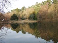
Nearby is Friday Street, a village that, according to the information, had been compared with Jack the HammerSwitzerland due to its large mill-pond and steep wooded valley. Frankly we weren’t convinced with the Swiss comparison. Nevertheless, it was an attractive pond that we will visit again in the autumn as it should be stunning with the autumn colours reflected.

Mill-pond at Friday StreetThe last stop was Arbinger Common with the old village stocks still there, now with the villagers locked out by a fence rather than locked in. This has been called ‘England’s oldest village’ since evidence of occupation 7000 years ago was discovered nearby in 1950.